 Â
Â
Â
Â
 Location:Â Roseway Beach Road
Shoreline: sand beach
Type of access: gravel road approximately 2 kil. long to beach
Parking: yes
Government wharf: no
Public slipway: no
Public concrete ramp:Â no
Public access
Topographic reference: 20p/11(Lockeport)
Marine chart # 4241(Lockeport-Cape Sable)
UTM grid: E0310465 Â N4830147
Latitude: N 43° 36.155’ /Longitude: W 65° 20.871′
Â
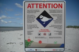
Roseway Beach can be busy during the summer months and has limited parking, a good place to play in the surf if you are an experienced paddler. This beach is also one of the Piping Plover nesting beaches, and has a protective area for the nesting birds.
