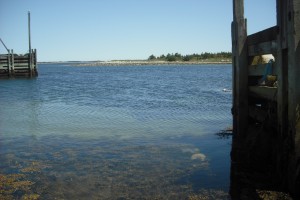
Shoreline: rocky
Type of access: paved road to wharf
Parking: yes
Public concrete ramp: yes
Topographic reference: 20p/6 (Baccaro)
Marine chart # 4241 (Lockeport-Cape sable)
UTM grid:
Latitude: N 43° 29.142′ /Longitude:W 65° 27.854′
Public access, the wharf is no longer in use for fishing boats,although it is a relatively new wharf.This was once the site of a fish plant,buildings are no longer in use.From Smithville you can paddle up to Port La Tour Wharf stopping along the way to explore islands and Crow’s Neck Beach, a beautiful white sand beach. with a lagoon in behind.Further up the harbour is Seal Point Wharf. It is difficult to land here, although it makes for an interesting paddle I suggest to paddle back to Port LaTour or Smithville wharf.

