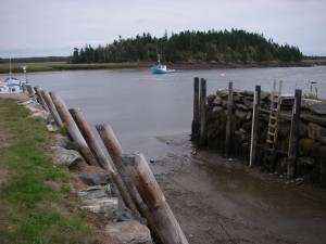
 Location: Chebogue River Aquatic Club
Shoreline: gravel
Type of access: gravel road
Parking: yes, in parking lot
Government wharf: no
Public slipway: yes
Public concrete ramp: yes, accessible in low tide
Topographic reference: 20-0/16 (Yarmouth)
Marine chart # 4243 (Tusket- Cape Saint Marys)
UTM grid: E0734808 Â N4854541
Latitude: N43° 48.399′ / Longitude: W066° 04.850′
Name of owner: Chebogue River Aquatic Club (land around the road and slip)
Public access
The road and the slip are public but the Aquatic Club owns the surrounding land. There is a parking area provided.  Check in at the Clubhouse before leaving vehicles in the parking area if there is anyone there, or park back in the boat storage area after you launch your kayak.
