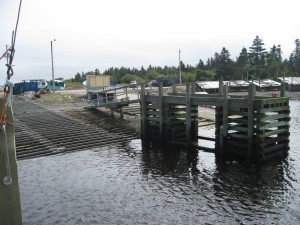
 Location: Port La Tour wharf, Commercial Street
Shoreline: rocky
Type of access: gravel road to wharf
Parking: yes
Government wharf: yes
Public slipway: yes
Public concrete ramp: yes
Topographic reference: 20p/6 (Baccaro)
Marine chart # 4241 (Lockeport-Cape sable)
UTM grid E0300184 Â N4818829
Latitude: N43° 29.847’/Longitude:W 65° 28.238′
Public access
Â
A pleasant and interesting paddle route can be enjoyed by launching at Port La Tour Wharf and exploring around Johns Island and on up through the haulover and into Negro Harbour. Once here you can be picked up by the Blanche Road bridge, or paddle on up to Port Clyde to the public access at Strangs Lane. This trip provides a very scenic paddle with a variety of options. This route can be very easily made into an all day outing.
To do this trip you will also need topographic map # 20p/11 (Lockeport)
If you are paddling out around Baccaro Point (Lighthouse) and to the west of Baccaro, take precautions of the wind and tides.
Â
