We are attempting to upgrade our index information on canoe launch sites in southwest Nova Scotia. We will add more as they become available.
Our site provides information on places where permission has been granted for launching. However, if you see an attractive site not listed as public access local property owners are usually glad to give permission for access and maybe some advice.
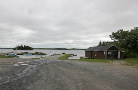
Site Name: Great Pubnico Lake
Location: Take exit 31 off the 103 on the road to the golf course (not to the village of Pubnico) Follow that road for 50-100 M and turn right (away from the golf course) going for 5.6 km on a well maintained gravel road. There will be clear access to the lake and a small wharf. Shoreline: Sandy/gravel beach. Very gradual slope Type of access: Vehicle can be unloaded within 10 feet of the waterline. Parking: There is ample parking but it is courteous to park away from the beach. Government facilities: None Public slipway: Yes Public Concrete Ramp: No Topographic Reference: Marine Chart #: UTM grid: Latitude: N43 44.222 Longitude: W 065 43.633 Public Access Description: Drive as close to the water line as you dare, unload your canoe/kayak and park out of the way. Do not block the wharf or the boat house. The area near the boathouse is private property but the owner has allowed access.Caution: This is a large lake and it easy to get disoriented. Preferable to have a GPS to manage a safe return to the launch site. Don’t forget extra batteries.
 Site Name: Slate Falls Dam/Quinan
Location: Located at the end of the Frotten Road. To get there from Tusket, follow 308 to Quinan. Pass the Community Hall and Church in Quinan, go over the bridge and start looking on the right for the Frotten Road. From the start of the Frotten Road to Slade Falls is a total of 11.5km. The first 2 km is paved; the next 3.7 km is a fairly wide dirt road with large 2†and 4†clear stone (rough in places but solid) and takes you to a small bridge immediately followed by a large estate. The road goes to the left of the property, narrows, and gets worse for the remaining 5.8 km, but is also solid. Shoreline: Rocky large gravel. Easy access to the water Type of access: Gentle slope to the water. From here, easy access to Gull Lake, Great Barren and Quinan Lake. (Note: Short portage into Quinan Lake. First 100 ft. steep incline; rest a clear/easy footpath.) Parking: There is lots of parking on a grass field close to the dam. . Government facilities: There is a remotely supervised government dam. Public slipway: No but a gently sloped gavel driveway to the water. Would be good for 4WD vehicles. Public Concrete Ramp: No Topographic Reference: Marine Chart #: UTM grid: Latitude: Longitude: N43-52-527 W 065-44-676 Public Access Description: Fair access to the site via government maintained road. The road gets rougher and more narrow at the half way point (past the “estate.â€) Although it’s solid and can be managed in a small car driven with care, this is not recommended. Preferred vehicle would be a 4WD, or truck with good clearance. Â Site Name: Doctors Lake
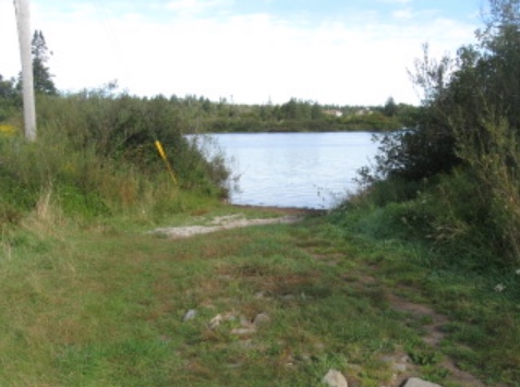
Location: Go north on Main Street, Yarmouth and follow Route #1. The turnoff #1 in Dayton 2 km from the Town line. The turnoff is signposted Chegoggin and the launch site is about 20 metres from the turnoff on the right. Shoreline: Type of access: There is a launch suitable for power boats into the lake. Parking: There is room to park 2 or 3 cars. Government facilities:None Public slipway:Yes Public Concrete Ramp: No Topographic Reference: Marine Chart #: UTM grid: Latitude: Longitude: N43-52-419 W 066-06-304 Public Access Description: There is a gravel driveway leading directly to the lake Â
 Â
Â
Site Name:Â Lake Milo
Location: Located on extreme north end of Main Street, Yarmouth clearly identifiable by the Milo Boat house. Belongs to Town of Yarmouth. Shoreline: Rocky Type of access: Direct access off Main Street to parking lot. Parking: There is limited parking at the edge of the lake. Across Main Street there are two parking lots. The lower one reserved for the RCMP and an upper one that is free to the general public. Government facilities: The boat house is open and supervised during the summer months. It has washrooms, meeting rooms and a lifeguard is on duty during posted hours. Public slipway: Yes Public Concrete Ramp: ?? Topographic Reference: Marine Chart #: UTM grid: Latitude: Longitude: Public Access Description: The boat house is located on Main Street with limited on site parking. Across Main St there are two parking lots. One is for the RCMP but the one higher up is open for the public. Â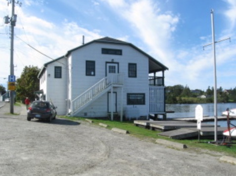 Â
Â
Site Name: Quinan Lake
Location:  From the Church in Quinan (on route 308) drive further along another 5 km to where the pavement ends. To the left will be the Coldstream Road. Turn RIGHT onto the Shunacady Road. This road is not marked as such, although you will find it on a topo map and Google maps.

 From the turn, drive 20.8 km and you will be at the small bridge where you can park and set off on your paddle.

  NOTE 1. There are no sides to the bridge. It just covers a small stream and is made of heavy wooden beams over the road and is very safe to drive over.  

NOTE 2: the first 3 km of dirt road are rough and if there’s been a rain, there may be large pools of water on the road but they are not deep. The road is solid and, after 3 km, gets a lot better and is fine all the way in.

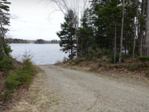
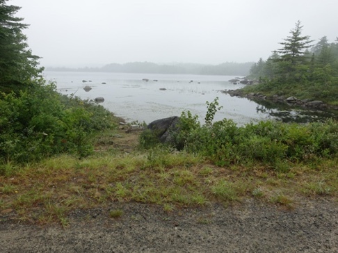
 The “landing” to get into Quinan lake is immediately to the right of the little bridge, mere feet from the road.

  Parking: Plenty of space to park (and turn around) on the side of the road just past the bridge. Shoreline: There are campsites on at least three islands. The largest one is on the big island on the centre of the lake. A smaller island just before that has a small campsite. A larger L-shaped (double island that’s connected with a sand bar when the water is low can support three tents. Type of access: Access to the lake is a short steep drop next to a small bridge. It’s not ideal but not very difficult. Parking: Both sides of the bridge provide ample room for parking several cars. Government facilities: There are no facilities Public slipway: There is no public slipway. Public Concrete Ramp: There is no ramp Topographic Reference: Marine Chart #: UTM grid: Latitude: Longitude: N 43.83181 W 065.65844 Public Access Description: From the end of the pavement in Quinan it will take about 1 hour to reach the bridge where you launch. The first part of the gravel road (3 km) is rough in spots but there is no danger of getting stuck or damaging your vehicle. The government maintained fire road (17.8 Km after the first 3km) is in very good shape with a few pot holes. Again no danger of getting stuck in mud. Â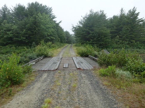 Â
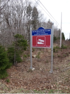
Site Name: Wentworth Lake
Location: In the community of Wentworth on highway 340, 22 km from Carleton and 32 km from Weymouth.
Shoreline:
Type of access: Turn off the 340 At the launch site
Parking: Ample gravel parking
Government facilities: Adjacent to the launch site is a small park with washrooms, garbage collection.
Public slipway: Gravel and low slope
Public Concrete Ramp:
Topographic Reference:
Marine Chart #:
UTM grid:
Latitude: Longitude: N44 – 10.617 W 065 – 56.640
Public Access Description: Clearly marked entrance to launch site.
Contact Person: Arnold Comeau at 769-3655 or HYPERLINK “mailto:acomeau@municipality.clare.ns.ca” \t “_blank”  acomeau@municipality.clare.ns.ca
   Â
