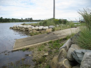
 Location:Â Strangs Lane
Shoreline: mixed
Type of access: gravel road
Parking: yes
Government wharf: no
Public slipway: no
Public concrete ramp: yes
Topographic reference: 20p/11(Lockeport)
Marine chart # 4241 (Lockeport-Cape Sable)
UTM grid: E0300966 Â N4830147
Latitude: N 43° 35.964′ /Longitude: W 65° 27.902′
Â
Public access
Location:Â Strangs Lane
Shoreline: mixed
Type of access: gravel road
Parking: yes
Government wharf: no
Public slipway: no
Public concrete ramp: yes
Topographic reference: 20p/11(Lockeport)
Marine chart # 4241 (Lockeport-Cape Sable)
UTM grid: E0300966 Â N4830147
Latitude: N 43° 35.964′ /Longitude: W 65° 27.902′
Â
Public accessThis makes an ideal access to Negro Harbour, the paddler can explore along the coast here and along the coast of Blanche. For a more adventuresome paddle if time and tide permit make a day trip out to Cape Negro Island or plan an overnight trip. If the tide is right you can paddle from Port Clyde to the Clyde River Bridge on the #103 highway.
The Municipality of Barrington provides picnic tables here at this access.
