 Â
Location: Breakwater Road
Shoreline: rocky
Type of access: gravel road to shore
Parking: yes
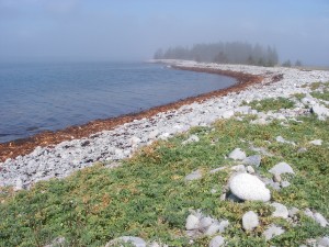
This was once a government wharf site, it is difficult to land on the cobble stones.If you paddle around the cobble spit in to the protected area it is much easier to take out or launch.
Topographic reference: 20p/14 (Shelburne )
Marine chart #4241(Lockeport- Cape Sable)
UTM grid: Â E0321306 Â N4847864
Latitude: N 43° 45.845’ / Longitude: W 65° 13.162
Name of owner: Public road
February 2026 M T W T F S S 1 2 3 4 5 6 7 8 9 10 11 12 13 14 15 16 17 18 19 20 21 22 23 24 25 26 27 28 -
Recent Posts
Archives
Categories
