 Â
 Â
Â
Location: Stephens Road (near Oak Point on map)
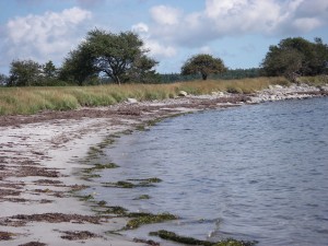
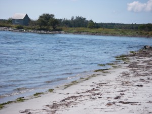
Shoreline: sand beach, and beach stone
Type of access: rough paved road, 1 kil. from #3 highway
Parking: There may be room for 1 vehicle,best to use as a pick-up or drop off site.Â
Topographic reference: 20p/11(Lockeport)Marine chart #: 4241 (Lockeport-Cape sable)
UTM grid: E0326583 Â N4844447
Latitude: N 43° 44.077’/ W Longitude:65° 09.164′
Name of owner: Public road goes right to beach, easy access.
Â
Â
Location: Stephens Road (near Oak Point on map)
Shoreline: sand beach, and beach stone
Type of access: rough paved road, 1 kil. from #3 highway
Parking: There may be room for 1 vehicle,best to use as a pick-up or drop off site.Â
Topographic reference: 20p/11(Lockeport)Marine chart #: 4241 (Lockeport-Cape sable)
UTM grid: E0326583 Â N4844447
Latitude: N 43° 44.077’/ W Longitude:65° 09.164′
Name of owner: Public road goes right to beach, easy access.
Private land on both sides of the road. Owner doesn’t mind paddlers using area for a drop off or pickup area.This location gives the paddler a good access to Green Harbour, exploring both sides of the  harbour and Egg Island.If paddling the coastline from Lockeport to East Green Harbour be cautious off Western Head.
There are no conveniences in East Green Harbour, West Green Harbour or East Jordan until you are back out on the 103 highway.
