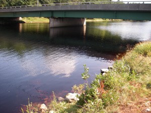
 Location:Â Sable River Bridge.
Shoreline: rocky, gravel
Type of access: You can drive down into the field just above Sable River Bridge(103 highway)
Parking: parking available at car pool area by Lockeport exit #23 or in field next to access.
Government wharf: no
Public slipway:no
Topographic reference: 20 p/14 (Shelburne )
Marine chart #: 4240 (Liverpool-Lockeport)
UTM grid: E0333905 Â N4856097
Latitude: 43° 50.464′ N/Longitude: 65° 03.991′ W
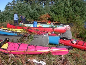
Private landowner has given paddlers permission to use this as an access to paddle down the Sable River.Please respect private property at all times.
Â
Sable River Walking Trail is nearby, cross at the Foot bridge Trail and the Tom Tigney Trail,this is called “going around the River’. Sable River has the only pedestrian suspension foot bridge in Nova Scotia.
Â
From this location to Louis Head Beach makes a very interesting and beautiful paddle, you can arrange to be  picked up at the beach or plan to camp overnight at the Louis Head Beach Campground. Be sure to check for low tide, paddling is impossible at this time.
There is a small canteen and other ammenities at the campground
Sable River has 2 garages on the # 103 near the Sable River Bridge which also carries  snacks, hot and cold drinks.  Provincial Park picnic area is located just off the #103 highway, Lockeport exit 23.
