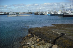
 Location: West Head, Cape Sable Island
Shoreline: rocky
Type of access: paved road
Parking: yes
Government wharf: yes
Public slipway: yes
Public concrete ramp: yes
Topographic reference: 20 p/5 (Cape Sable Island )
Marine chart # 4241 ( Lockeport- Cape Sable )
UTM grid: E0285261 Â N4814922
Latitude: N 43° 27.481′ /Longitude:W 65° 38.006
West Head is another busy fishing Wharf and the port for The Coastguard Rescue Boats.
Also within walking distance from this wharf is a Seafood Take-Out, a generous helping of  delicious local seafood is served here. Picnic tables / no bathroom facilities.
