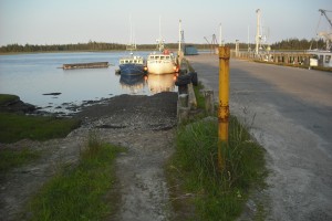
 Location: Town Point Wharf ( drive to end of Town Point Road)
Shoreline: rocky, mud flats
Type of access: paved road
Parking: yes
Government wharf: yes
Gravel access to the left and right before the dock starts
Topographic reference: 20-0/16 (Yarmouth)
Marine chart # 4243(Tusket- Cape Saint Marys)
UTM grid: E0733744 Â N4851138
Latitude: N43° 46.583’ / Longitude: W066° 05.729′
Public access
Do not try to access from here when tide has dropped as there are mud flats from shoreline.
