 Â
Â
 Location: drive to end of gravel road
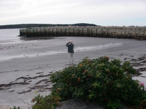
Shoreline: sand beach
Type of access: drive to end of paved road in Comeaus Hill then drive to end of gravel road
Parking: yes
Government wharf: old wharf
Public slipway: no
Public concrete ramp: no, access from sand beach
Topographic reference: 20-0/9 (Comeaus Hill)
Marine chart  #4244 (Wedgeport and vicinity)
UTM grid: E0739821(40) Â N4841000 (41)
Latitude: N 43° 41.115’ /Longitude: W 66° 01.443′
 Public access from the beach
Comeaus Hill is an excellent launch site for paddling to the Tusket Islands.This launch site has picnic tables, firepits and bathroom facilities. A magnificent view of the ocean and nearby Tusket Islands.
For more information about paddling to the Tusket Islands contact: Kendrick d’Entremont email:<ken.dentremont@hotmail.ca> Phone: 902 762-2191
