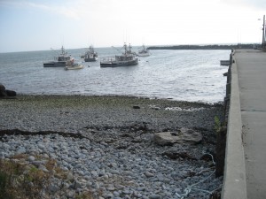
38. Chemin du Rocher
 Location: Chemin du Rocher, Middle West Pubnico
Shoreline: beach stone
Type of access: gravel road
Parking: yes
Government wharf: yes
Public slipway: no
Public concrete ramp: gravel access
Topographic reference: 20p/12 ( Pubnico)
Marine chart # 4244 (Wedgeport and vicinity)
UTM grid: Â E0272617 Â N4836925
Latitude: N 43° 39.135′ /Longitude:W 65° 47.314′
Public access, a stone breakwater helps to shelter the boats next to the wharf.
Lighthouses that can be seen from the wharf are: White Head, Peases Island, Fish Island, Seal Island
http://www.museeacadien.ca/english/events/tern.htm Â
