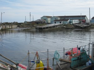
 Location: Bulls Head Wharf
Shoreline: rocky
Type of access: paved road
Parking: yes
Government wharf: yes
Public concrete ramp: a gravel, rocky shoreline that can be used is near the fish sheds.
Topographic reference: 20 p/5 (Cape Sable Island)
Marine chart # 4241 (Lockeport-Cape Sable)
UTM grid: E0292270 Â N4815723
Latitude; N 43° 28.050’/Longitude:W 65° 34.057’Â
Â
Keep in mind that the eastern side of Cape Sable Island boasts 9 miles of white sand beaches.
Location: Bulls Head Wharf
Shoreline: rocky
Type of access: paved road
Parking: yes
Government wharf: yes
Public concrete ramp: a gravel, rocky shoreline that can be used is near the fish sheds.
Topographic reference: 20 p/5 (Cape Sable Island)
Marine chart # 4241 (Lockeport-Cape Sable)
UTM grid: E0292270 Â N4815723
Latitude; N 43° 28.050’/Longitude:W 65° 34.057’Â
Â
Keep in mind that the eastern side of Cape Sable Island boasts 9 miles of white sand beaches.There is an easy access here inside the breakwater between the fish sheds.
This wharf is very busy most times as Stoney Island Fisheries is located here.
