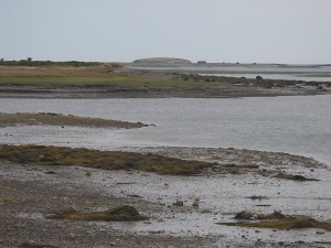
 Location: William Allan Road, drive 1.7 kils to end of road.
Shoreline: mixed
Type of access: paved road
Parking: limited parking
Government wharf: no, site of old wharf
Public slipway: no
Public concrete ramp: no, gravel access
Topographic reference: 20-0/16 (Yarmouth)
Marine chart # 4243 (Tusket-Cape Saint Marys)
UTM grid: E0735343 (35)Â N4849281 (49)
Latitude:N 43° 45.663’  / Longitude: W 66° 04.542′
Public access
During clam season boats are often tied up here, local people comment that you can get out  through the channel on low tide.
On the #3 highway when you arrive in Arcadia there is an Irving Garage and Arcadia Convenient Store. This is the only place to get supplies until you reach the town of Yarmouth.
