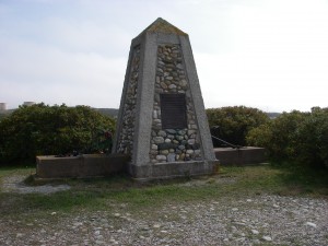
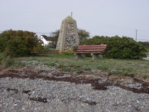
05. Fisherman’s Monument

 Location: Fishermens Monument (Memorial site) take road to Cape Forchu
Shoreline: beach stone
Type of access: paved road
Parking: yes
Gravel access
Topographic reference: 20-0/16 (Yarmouth )
Marine chart # 4245 (Yarmouth Harbour and Approaches)
UTM grid: E0731273 Â N4857004
Latitude:N 43° 49.125’ /Longitude:W 66° 08.587′
Public Access
Be constantly aware of the tides and weather especially around the headlands such as Cape Forchu.
This access gives the paddler a chance to explore around this side of Yarmouth Harbour, in the coves and inlets, keeping in mind the wharf at Yarmouth Bar is a very busy one and this area cannot be paddled at low tide. Always keep in mind the tide and weather, at present there is no public ferry coming into Yarmouth to connect with the United States.

 Location: Fishermens Monument (Memorial site) take road to Cape Forchu
Shoreline: beach stone
Type of access: paved road
Parking: yes
Gravel access
Topographic reference: 20-0/16 (Yarmouth )
Marine chart # 4245 (Yarmouth Harbour and Approaches)
UTM grid: E0731273 Â N4857004
Latitude:N 43° 49.125’ /Longitude:W 66° 08.587′
Public Access
