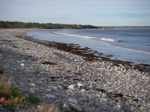
 Location: Round Bay Ferry Road
Shoreline: sand, beach stone
Type of access: gravel road
Parking: yes
Public beach access
Topographic reference: 20p/11 (Lockeport)
Marine chart # 4241 (Lockeport-Cape Sable )
UTM grid: E0310166 Â N4829508
Latitude: N 43° 35.771’ /Longitude :W 65° 21.091
Â
For the experienced paddler Round Bay Beach makes a good access to paddle along the coast stopping on Grey Island for a break and to explore. From Grey Island your next stop can be McNutt’s Island at the government wharf, here you can tent overnight or have lunch and paddle on up the Shelburne Harbour and exit at the Shelburne Harbour Yacht Club.
This makes a good full days paddle. Keep in mind the tide and wind conditions for this trip.
