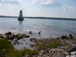
 Location: Sandy Point Lighthouse and Park
Shoreline: sand and rock
Type of access: gravel road
Topographic reference: 20p/11 (Lockeport)
Marine chart # 4241(Lockeport-Cape Sable)
UTM grid: E0312682 Â N4840057
Latitude: N 43° 41.502’ /Longitude: W 65° 19.413
Name of owner: Sandy Point Recreation Group
The Sandy Point Lighthouse Park overlooks the picturesque Sandy Point Lighthouse and Shelburne Harbour. You can  even walk to the Lighthouse on low tide!
The Sandy Point Recreation Group supplies snacks, hot/cold drinks, grilled foods each day and if you time it just right you can enjoy a delicious homemade community breakfast or supper when advertised, before setting out for a days paddle or at the days end.
