 Location: Barrington Head
Shoreline: rocky
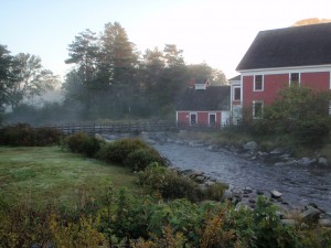
Type of access: paved road #103 highway at Barrington (Barrington Woolen Mill Museum)
Parking: yes, please park in Municipal parking lot across from the Barrington Post Office, do not use Woolen Mill Museum parking lot.
Government wharf: n/a
Public slipway: n/a
Public concrete ramp: n/a
Topographic reference: 20p/12 (Pubnico)
Marine chart # 4241 (Lockeport-Cape Sable)
UTM grid: E0291685 Â N4826852
Latitude: N 43° 34.074’/Longitude: W 65° 34.723′
Visit www.barringtonmunicipality.com , www.discovershelburnecounty.com and www.capesablehistoricalsociety.com
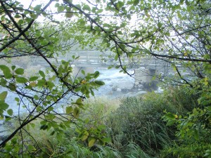
This access is usable at high tide using proper skills to enter and exit your kayak. Put in just above the concrete bridge. Toilets are open to the public during museum hours. Take time to visit the museums that are within walking distance. The next place to get groceries is on the way to Barrington Passage at Crowells Store or if traveling on the road to Yarmouth via the Barrington west exit there is a Convenience Store.
For more information on kayaking the Coastal Water Trail or for accommodations in the area contact Pat Hudson, (902)637-2940
Kayakers are welcome to tent overnight and use conveniences@ 42 River Road, Barrington.
