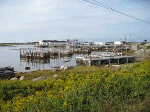
56. Daniels Head Wharf
 Location: Daniels Head Wharf (South Side Inlet)
Shoreline: rocky
Type of access: paved road
Parking: yes
Government wharf: Sable Fish Packers
Public concrete ramp: no, there is a gravel access on left just before Sable Fish Packers
Topographic reference: 20 p/5 (Cape Sable Island)
Marine chart # 4241 (Lockeport-Cape Sable)
UTM grid: E0290730 Â N4813331
Latitude: N 43° 26.733’/Longitude: W 65° 35.116′
Name of owner: Sable Fish Packers
Private access: yes, Sable Fish Packers has given permission for use.This launch site is well protected by the wharf and fish plant but it is easily accessable even in low tide by paddling up into the inlet near the road.
